File:Arroway.JPG
From D&D Wiki
Size of this preview: 800 × 542 pixels. Other resolutions: 320 × 217 pixels | 1,600 × 1,084 pixels.
Original file (1,600 × 1,084 pixels, file size: 861 KB, MIME type: image/jpeg)
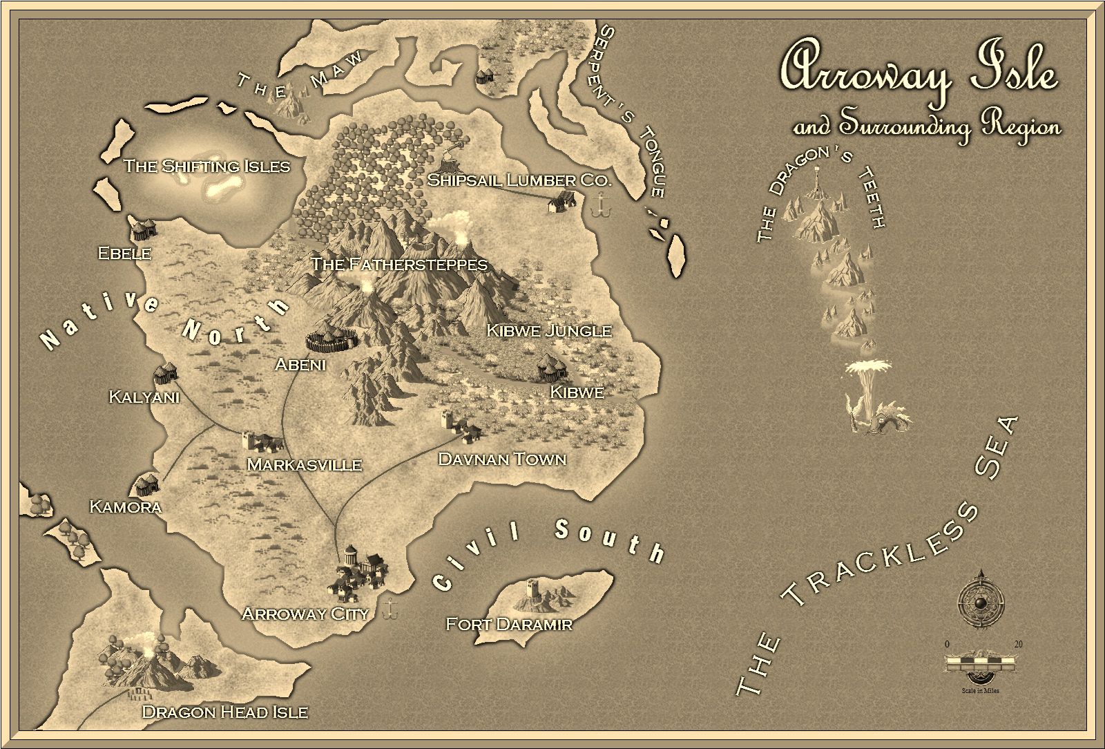
An overland map of Arroway Isle, free for use. Created by goldgrae.
Back to Main Page → 4e Homebrew → Maps → Continental Maps
Back to Main Page → 3.5e Homebrew → Maps → Continental Maps
Back to Main Page → D20 Modern → Maps → Continental Maps
File history
Click on a date/time to view the file as it appeared at that time.
| Date/Time | Thumbnail | Dimensions | User | Comment | |
|---|---|---|---|---|---|
| current | 19:49, 27 May 2012 | | 1,600 × 1,084 (861 KB) | Maintenance script (talk) | Importing from media.dandwiki.com |
You cannot overwrite this file.
File usage
The following page uses this file: