File:Vasuda (Geo)(Better).JPG
From D&D Wiki
Size of this preview: 800 × 510 pixels. Other resolutions: 320 × 204 pixels | 952 × 607 pixels.
Original file (952 × 607 pixels, file size: 151 KB, MIME type: image/jpeg)
Back to Main Page → 4e Homebrew → Maps → Continental Maps
Back to Main Page → 3.5e Homebrew → Maps → Continental Maps
Back to Main Page → D20 Modern → Maps → Continental Maps
File history
Click on a date/time to view the file as it appeared at that time.
| Date/Time | Thumbnail | Dimensions | User | Comment | |
|---|---|---|---|---|---|
| current | 22:18, 27 December 2014 | | 952 × 607 (151 KB) | Yossarian (talk | contribs) | Updated via GIMP. Updated terrain, removed Rome |
| 17:31, 27 May 2012 | 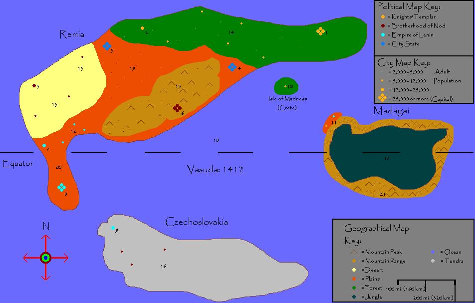 | 952 × 607 (56 KB) | Maintenance script (talk) | Importing from media.dandwiki.com |
You cannot overwrite this file.
File usage
The following page uses this file:
(Better).JPG&oldid=686281)
(Better).JPG)
(Better).JPG&action=edit&redlink=1)
(Better).JPG&action=edit)
(Better).JPG&action=history)
(Better).JPG)
(Better).JPG)
(Better).JPG&oldid=686281)