File:UrurMap.jpg
From D&D Wiki
No higher resolution available.
UrurMap.jpg (426 × 450 pixels, file size: 78 KB, MIME type: image/jpeg)
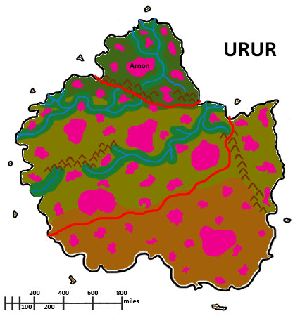
Map of the continent Urur in the Orizon setting. Skylands are marked with pink
File history
Click on a date/time to view the file as it appeared at that time.
| Date/Time | Thumbnail | Dimensions | User | Comment | |
|---|---|---|---|---|---|
| current | 01:21, 17 January 2015 | | 426 × 450 (78 KB) | Lemiel14n3 (talk | contribs) | Need to add names, but much better map |
| 14:14, 13 January 2015 | 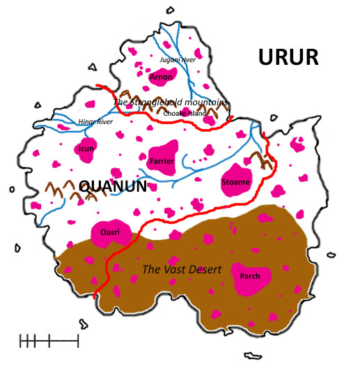 | 497 × 525 (102 KB) | Lemiel14n3 (talk | contribs) | Map of the Continent Urur in the Orizon setting |
You cannot overwrite this file.
File usage
The following page uses this file: