File:Teoryran Countries.PNG
From D&D Wiki
No higher resolution available.
Teoryran_Countries.PNG (800 × 406 pixels, file size: 38 KB, MIME type: image/png)
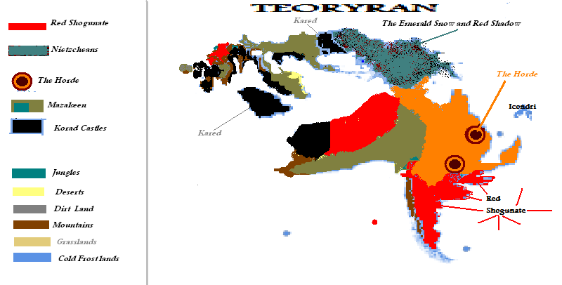
Political Map.
Back to Main Page → 4e Homebrew → Maps → Continental Maps
Back to Main Page → 3.5e Homebrew → Maps → Continental Maps
Back to Main Page → D20 Modern → Maps → Continental Maps
File history
Click on a date/time to view the file as it appeared at that time.
| Date/Time | Thumbnail | Dimensions | User | Comment | |
|---|---|---|---|---|---|
| current | 18:00, 27 May 2012 | | 800 × 406 (38 KB) | Maintenance script (talk) | Importing from media.dandwiki.com |
You cannot overwrite this file.
File usage
The following 2 pages use this file: